Georeferenced raster and supported CRS transformation with fail-closed validation.
Geometry, field-schema, path and content checks before project publication.
OUT08
Export and interoperability
GeoPackage 1.4, GeoJSON, KML, GPX, CSV/XLSX, DXF, PDF and technical formats.
QGIS/QGZ projects and QField packages with styles, labels, forms, attachments and basemaps.
Checkpointed/resumable export, package catalogue and compatibility validation.
LAN09
Sharing and local network
iOS share sheet, document providers and portable packages.
Local TV view with a simple URL and credential-protected WebDAV on trusted networks.
Desktop QGIS/QField workflows without a proprietary project cloud.
LOCK10
Security and privacy
Private projects, structured-data encryption and Keychain-protected keys.
Authorisation before sharing, path checks and atomic writes.
UMP-controlled ads only in Free/Trial; no ads on maps, LiDAR, RoomPlan or CarPlay.
UX11
Performance, accessibility and diagnostics
Memory, battery and performance profiles, progressive rendering and large-dataset handling.
Customisable map bars, control sizes, haptics, tooltips and reduced motion.
Six languages, VoiceOver, device/network diagnostics and local benchmarks.
What’s new
More information, in the same place.
From field sensors to 3D imagery: your tools come together in one project, from the site visit to the office.
SENSOR
A sensor and its place on the map
Connect a data service to a waypoint to read temperature, pressure, water level and other values without losing their location context.
Readings from compatible URLs, with authentication where required.
Local numerical history, charts, statistics and configurable thresholds.
Previously saved readings remain available offline; history stays on the device.
3D
Photos and LiDAR, together
Explore point clouds, surfaces and photos from the same scan. Photo-LiDAR fusion and resource management have been improved.
Adaptive photo capture and image selection for textures.
Project-specific archive, LAS import and viewing of recognised objects.
ICP alignment for segments or overlapping surveys; export supported products together or individually.
MAP
Better organised maps and waypoints
Choose individual or clustered points, organise data into layers and adapt maps to the job at hand.
Normal or cluster view, records with attachments and multiple links.
Choose a layer or create a new one while adding a point.
WMS maps with layer selection and editable sources; supported georeferenced raster import.
CAR
CarPlay: your points on the car display
Start navigating to a waypoint on your phone and, when CarPlay is connected, continue on the vehicle’s display with spoken directions.
Adjustable alert distance and voice preferences, including speech rate.
Map orientation, compass, GPS cursor and nearby waypoint summaries.
Set destinations and preferences while parked. CarPlay does not eliminate distraction risks.
Availability depends on the installed version, plan and device. Sensors need a configured compatible service; history is local and updates depend on connectivity and app activity. Continuous monitoring is not guaranteed. LiDAR and RoomPlan need compatible hardware. Certified surveying accuracy is not guaranteed.
Brochures
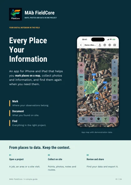
Every Place Your Information
Discover MAb FieldCore in four pages: a simple introduction to its features, practical examples and uses. Read and share it even with people who do not work with maps.