01
Prepare
Municipality, boundary, basemap and maps ready for offline use.
 MAb FieldCoreApp Store
 Maps, GPS, photos and sensor data in one iPhone and iPad project. LiDAR, RoomPlan, CarPlay and exports to continue your work in the office.
One operational workspace
for technical departments, professionals and field teams.
MAb FieldCore brings preparation, capture, quality control and export together in the same mobile project. Fewer manual handoffs, more context arriving intact at the office.
Municipality, boundary, basemap and maps ready for offline use.
Thematic OSM layers or the GIS files you already use.
GPS, waypoints, photos, measurements and LiDAR scans.
Attributes, geometries, symbology and missing fields.
GIS package, area PDF report or 3D point cloud.
Explore three stages of the same job. The information stays in one place and gains context all the way to delivery.
Record GPS tracks, waypoints, geotagged photos and — on compatible iOS devices — RGB LiDAR point clouds with manifests and integrity checks.

From map preparation to GIS delivery, the main tools stay in one project and preserve location, attributes and attachments.
Find the area, acquire boundaries and prepare authorized basemaps and archives so fieldwork can continue without a network.
Explore the workflow↗Follow live position and direction, record tracks and create points with accuracy, elevation and survey information.
Open the GIS demo↗Create and edit points, lines and areas; measure in the field and manage layers, attributes, geometries and symbology in one project.
Explore field surveying↗Attach photos and media to surveyed features while preserving coordinates, metadata and context for review and delivery.
View the media workflow↗On compatible iOS devices, capture color scans, inspect the point cloud in the 3D viewer and export LAS or LAZ.
Open the LiDAR demo↗Import and combine GeoPackage, GeoJSON, Shapefile ZIP, KML, GPX, DXF, CSV, WKT/WKB and other professional data.
Explore formats↗Check fields, geometries and CRS, then prepare QGIS and QField packages with layers, styles, photos and attachments.
Explore export↗On compatible vehicles or displays, show maps and waypoints, follow live GPS, navigate to the survey and control track recording.
Discover CarPlay↗Walls, openings and dimensions with 2D correction, 3D preview and technical GIS/CAD outputs.
Explore RoomPlan↗RoomPlan is the primary engine for detecting rooms, walls, doors, windows, openings and dimensions. ARKit Mesh Debug remains an optional quality-control layer and never replaces the structured survey.
Guided scanning on compatible devices and safe CapturedRoom storage in a dedicated survey folder.
Edit lengths, openings and alignment; add or remove walls, apply orthogonal snapping and work on multiple segments.
2D and 3D previews, survey thumbnails and optional ARKit Mesh Debug for geometry comparison.
Export the original RoomPlan USDZ, 2D/3D DXF for CAD workflows, survey PDF and technical JSON with dimensions and local coordinates.
Start navigating to a waypoint on your phone and, when CarPlay is connected, continue on the vehicle’s display with spoken directions.
Update the driving session with visible layers and the points you need for the job.
View the live position on the display whenever a valid fix is available.
Use a selected road, waypoint, line or area as the destination.
Start or stop track recording from the CarPlay controls.
MAbMAb FieldCore closes the gap between the person collecting the data and those who need to review, process or deliver it.
Let’s discuss your workflow ↗Prepare maps and data before heading out and keep the project operational in the field.
Location, photos, attributes, measurements and metadata stay attached to the same feature.
Multi-format import avoids advance conversions and unnecessary desktop steps.
Validation and structured packages help data, styles and attachments arrive together.
From field sensors to 3D imagery: your tools come together in one project, from the site visit to the office.
Connect a data service to a waypoint to read temperature, pressure, water level and other values without losing their location context.
Explore point clouds, surfaces and photos from the same scan. Photo-LiDAR fusion and resource management have been improved.
Choose individual or clustered points, organise data into layers and adapt maps to the job at hand.
Start navigating to a waypoint on your phone and, when CarPlay is connected, continue on the vehicle’s display with spoken directions.
Availability depends on the installed version, plan and device. Sensors need a configured compatible service; history is local and updates depend on connectivity and app activity. Continuous monitoring is not guaranteed. LiDAR and RoomPlan need compatible hardware. Certified surveying accuracy is not guaranteed.
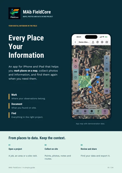
Discover MAb FieldCore in four pages: a simple introduction to its features, practical examples and uses. Read and share it even with people who do not work with maps.
Download the brochureYes. You can prepare maps and geographic archives in advance, then keep viewing, surveying and organizing data in the field. Operations that download new online sources naturally require a connection.
No. GIS, GPS, waypoints, photos, measurements, import and export remain available on supported devices. LiDAR scanning is an additional module for compatible iPhone and iPad devices.
Yes. MAb FieldCore generates packages containing a QGZ project, GeoPackage, styles and attachments, as well as many open formats. The goal is to continue working without rebuilding the project from scratch.
You can bring a dedicated session with the map and waypoints to the display, view the live GPS position, navigate to the selected feature, and start or stop track recording. A compatible vehicle or display connected through Apple CarPlay is required.
Technical departments, surveyors, engineers, architects, GIS professionals, maintenance teams, network operators and field crews. Engineers and architects can use LiDAR and RoomPlan for indoor surveys, 2D/3D geometry and CAD exports while keeping everything in the same GIS workflow.
Download MAb FieldCore for iPhone and iPad and take your data into the field, from the map to the survey and a shareable GIS package.